Space Products & Innovation
Transportation, Logistics, and Manufacturing
Solving Space Junk Problem Could Net Federal Prize
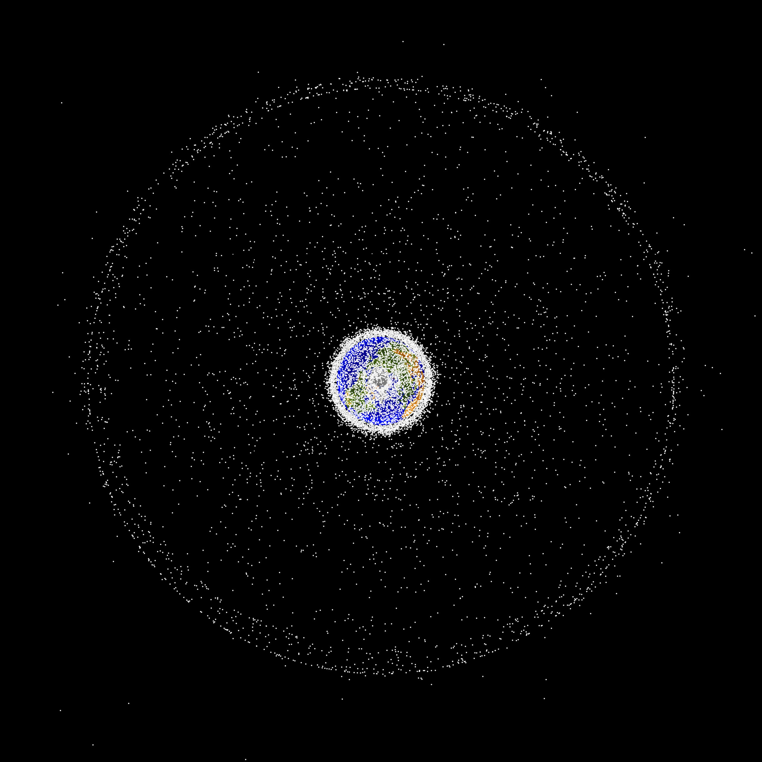
A grand prize could be in the offing for inventors who come up with new methods to prevent orbiting debris or design tools that can clean up space junk, according to recommendations from the White House’s Office of Science and Technology Policy.
2020 TSRQ3 – Space Products & Innovation
The increased use of satellite imagery and data in recent years has led to expansions in multiple fields of research. The utilization of satellites has developed beyond just tracking weather patterns. Satellites are now used to study . . .
2019 TSRQ1 – Space Products & Innovation

Companies and individuals are using positioning, navigation and timing (PNT), Earth observation (EO), and communication satellite technologies and data to humanity’s benefit. From commercial transportation to natural disaster relief, these products and services are changing, for the better, the way humans . . .
2016 – Imagery, PNT, Data, and the Self-driving Car
When space and data technology come together in a car, the car starts knowing where it is.
2016 – Matching Electric Vehicles to Charging Stations
Positioning, navigation, and timing technology comes together with databases, and socially-networked communications to pinpoint charging station availability.
Products and Services: Space Products and Services – TSR 2015
The Train Network
Trains are using satellite technology—such as position, navigation, and timing (PNT) receivers and communications—to provide a train’s precise position to the people who manage European railway systems. While a train’s movements and schedule might be generally well-known, the PNT reporting will allow for a train’s precise position to be reported to a rail traffic control center, using a combination of 3G/4G data and satellite-based broadband services.
Virtual Eyes Provided Through Imagery, Radar, and Geolocation
Some products tie together multiple space-based technologies, combining them for use in the aviation industry. Hardware and software products, such as 3D-Pilot developed by avionTek, are designed to give pilots situational awareness while flying and landing in low visibility conditions and bad weather.
Ridesharing’s Dependence on Satellite Geolocation
Ride-sharing services are an increasingly popular form of urban transportation that depends on geolocation services provided by satellites. Companies such as Uber and Lyft offer smartphone applications that allow a prospective rider to use the smartphone’s satellite navigation chip to identify the location at which the rider wishes to be picked up.