2016
2016 – Infrastructure: Space Infrastructure

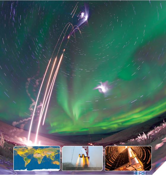
Space infrastructure is a fundamental prerequisite for all activities that make use of space. It comprises all the hardware, software, and operators responsible for creating and supporting the construction, launch, and deployment of spacecraft.
2016 TSRQ1 – Space Products & Innovation

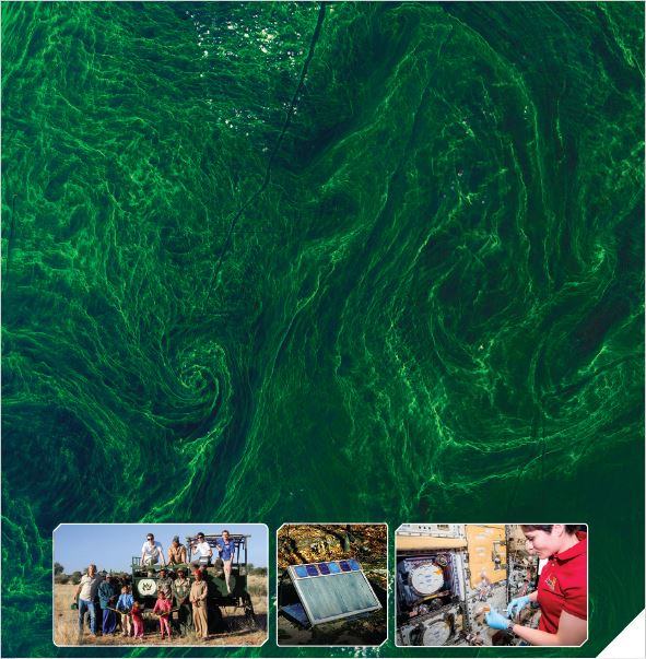
As humans continue to explore space, their ingenuity brings the technology used for space operations and exploration down to Earth. Whether leading sport-fishermen to a favorite fishing hole, or helping farmers predict crop yields, space products and services continue to make things convenient for humans and help them survive during turbulent times.
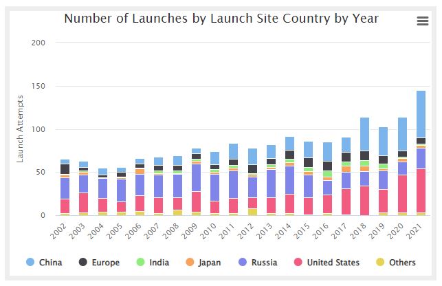
Number of Launches by Launch Site Country per Year
Mass Launched by Intended Orbit
… Thank you for visiting The Space Report! The Authoritative Guide to Global Space Activity, Packed with Over a Decade of Data, Resources, and Information. VIEW SUBSCRIPTION PLANS Username Password Remember Me Forgot Password
European Space Industry Workforce by Country 2000 – 2020
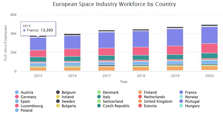
Stacked bar chart showing a twenty-year look at the European space industry workforce by country 2000 – 2020
NASA Civil Servant Workforce 2008-2017

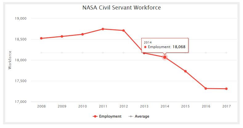
NASA Civil Servant Workforce chart showing the average and actual employment for the years 2008 through 2017.
2015 – U.S.: ATRR, GSSAP, ANGELS, and SBSS – Snapshot
The majority of known space-based SSA satellites are run by the U.S. Air Force’s 1st Space Operations Squadron (1 SOPS) from Schriever Air Force Base, Colorado.
2015 – EUMETSAT Space Budget – Snapshot
The European Organisation for the Exploitation of Meteorological Satellites (EUMETSAT) had a total budget of €418.1million (US$466.3 million) for 2015, the most recent . . .
- « Previous
- 1
- …
- 20
- 21
- 22