Infrastructure
Earth Observation/Remote Sensing Satellites
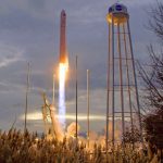
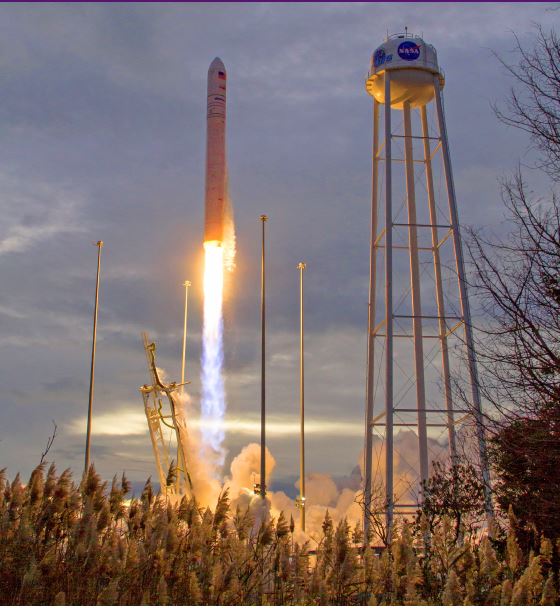
OSIRIS-REx delivers asteroid sample after seven years in space
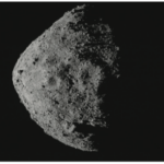
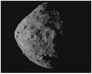
NASA’s OSIRIS-REx spacecraft returned a sample from the asteroid Bennu, which could help scientists better understand the formation of the solar system. After more than a decade of planning and seven years of space flight traversing more than 1 billion miles, a sample from the asteroid Bennu safely landed on Earth.
2018 – Earth Observation/Remote Sensing Satellites
Of the 465 spacecraft deployed in 2018, 38% (176) were deployed for Earth Observation/Remote Sensing (EO/RS) missions. While this is . . .
2018 – EO/RS Meteorology – Snapshot
In 1900, a hurricane defied U.S. Weather Service predictions and destroyed Galveston, Texas. The highest part of the island on which the city rests is about 2.75 meters (9 feet) above sea level. Death toll estimates vary, but at least . . .
2018 – EO/RS Satellite Manufacturers – Snapshot
Three manufacturers accounted for 47% (83) of all EO/RS satellites deployed in 2018: . . .
2018 – EO/RS Satellite Operators – Snapshot
The countries with spacecraft operators operating the most EO/RS satellites deployed in 2018 were in the U.S. and China. Combined, operators from these two countries accounted for . . .
2018 – EO/RS Satellites Payload Type Breakdown – Snapshot
Optical payloads constituted the largest share of the payloads of the 176 EO/RS satellites deployed during 2018, 82% (144); they were deployed primarily to . . .
2018 – EO/RS Satellites Mission Segment Breakdown – Snapshot
Of the 176 EO/RS satellites deployed in 2018, a majority, 56% (98), were deployed for commercial purposes. The 98 satellites are . . .
2018 – Infrastructure: Space Infrastructure
Space infrastructure, like its terrestrial counterpart, is an invisible backbone for services used by people all over the world. Like terrestrial infrastructure, space infrastructure is increasingly relied upon for convenience, services, and . . .
2017 – Military Satellites – Snapshot
National security drives national efforts to acquire and operate military satellites. While there some exceptions, most military satellites have very similar capabilities as their commercial…
2017 – Surface Imaging – Snapshot
Surface imaging satellites observe, monitor, and track changes and developments on the Earth’s surface using a variety of optical or electronic imaging capabilities. EO satellites…